I thought this was interesting! Google is taking anonymized, aggregate data from Google Maps for public health officials to understand responses to social distancing guidance related to COVID-19.
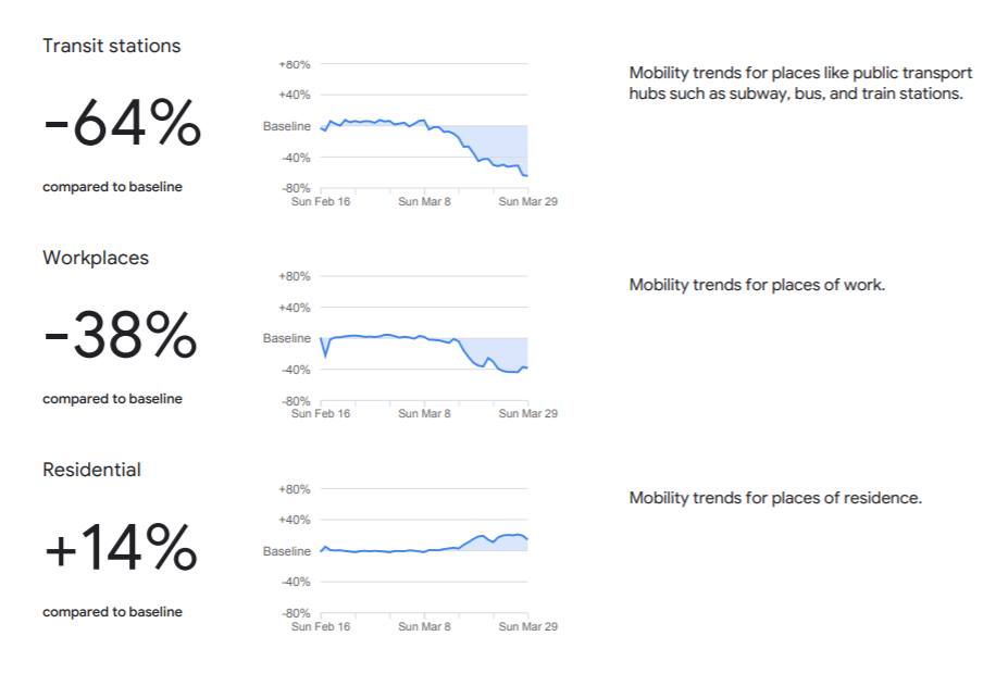
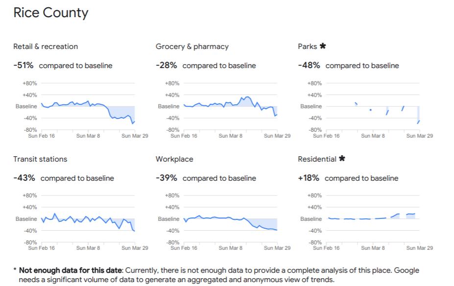
Here is the data I pulled for the state of Minnesota. It looks like in general, 38% less people are travelling to work, 35% less people are travelling to grocery stores and pharmacies, and 58% less people are travelling to restaurants, cafes, and shopping centers. Rice County seems to be doing slightly worse at sheltering-in-place compared to the average in Minnesota, except in the travelling to work and parks categories.
Source: COVID-19 Community Mobility Reports (https://www.google.com/covid19/mobility)